
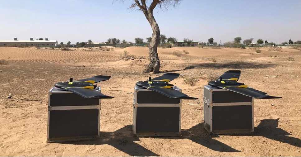
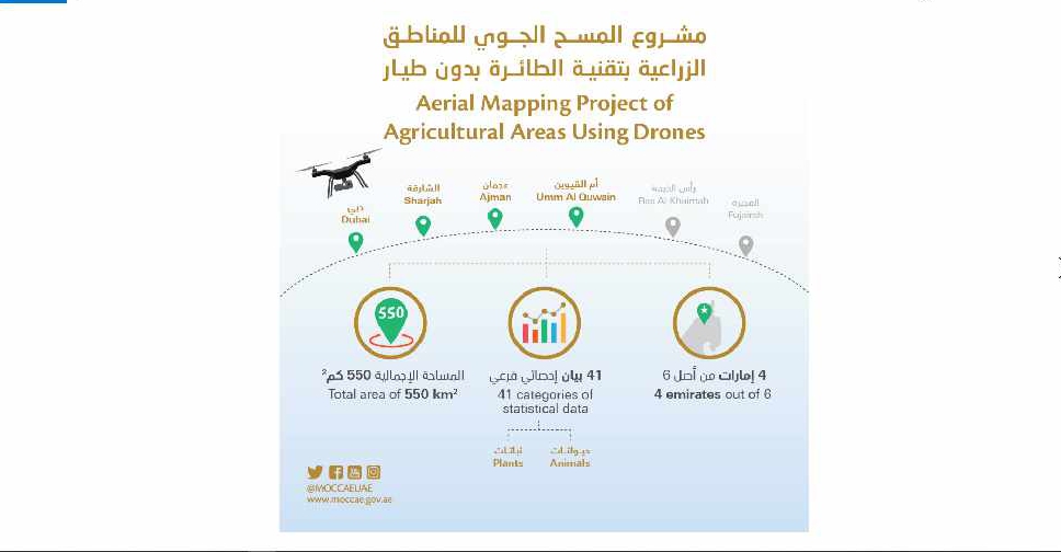
A project to map agricultural areas in the UAE using drones has completed its first phase.
It’s captured around 550 square kilometres of land across Dubai, Sharjah, Ajman, and Umm Al Quwain so far.
The Ministry of Climate Change and Environment will use the data to monitor crops and help farmers with forward planning.
Agricultural areas in Fujairah and Ras Al Khaimah will be mapped in the project's second phase later this year.

 UAE refutes Iranian allegations at BRICS meeting
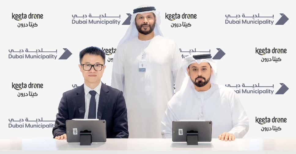 Dubai to launch drone delivery services at parks, beaches
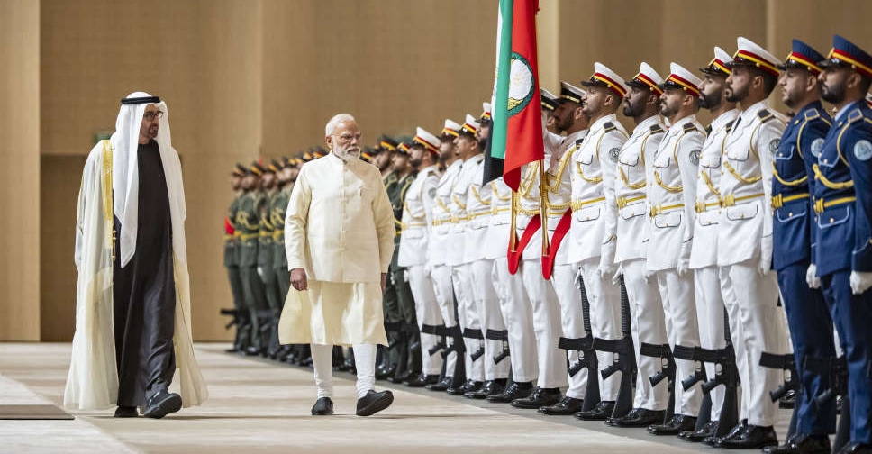 UAE, India ink defence, energy partnerships as Sheikh Mohamed meets Modi
 UAE issues advisory over Danalac infant formula
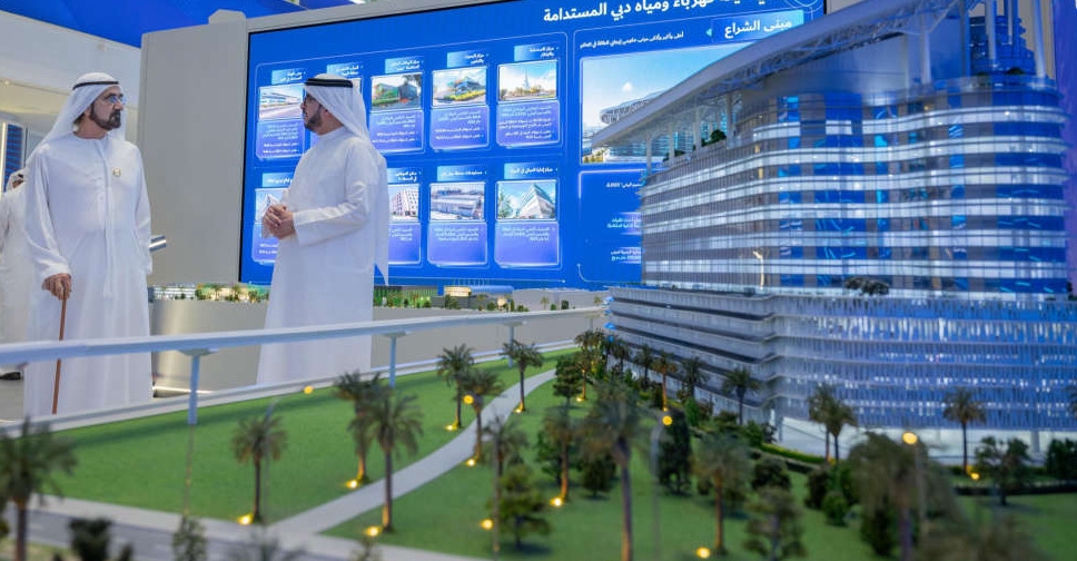 H.H. Sheikh Mohammed opens DEWA's 'largest, smartest net-zero energy' HQ
 UAE to restore Umayyad Mosque in Syria's Damascus
 WATCH: Dubai driver caught for reckless stunts on high-speed highway
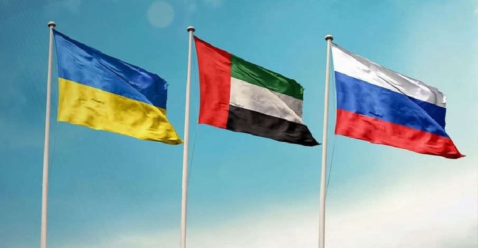 UAE brokers new round of Russia-Ukraine prisoner exchange
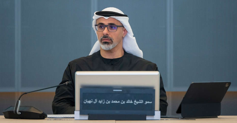 H.H. Sheikh Khaled briefed on West-East oil pipeline project
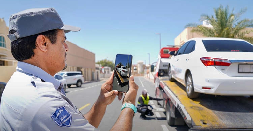 Dubai's RTA impounds over 9,000 cars in 2025 for illegal parking
 UAE condemns attack on Indian-flagged ship off Oman coast
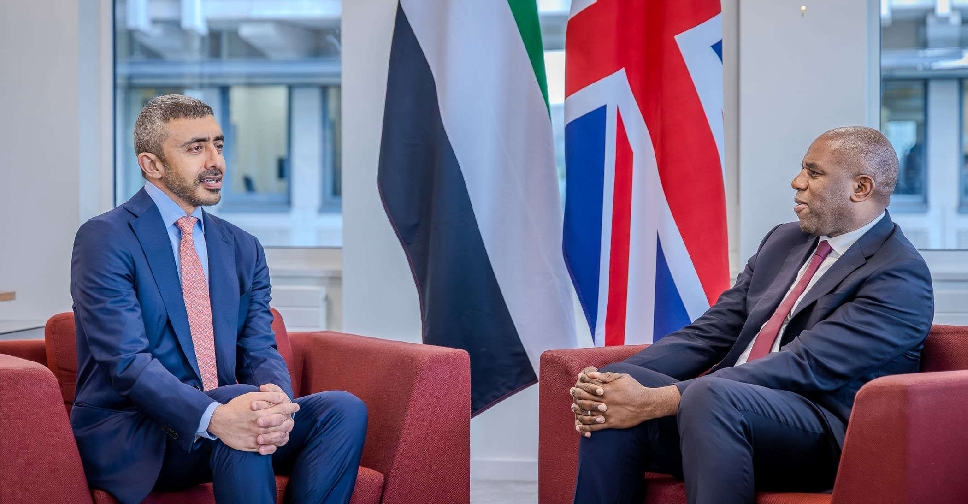 UAE, UK ministers discuss regional stability, bilateral ties
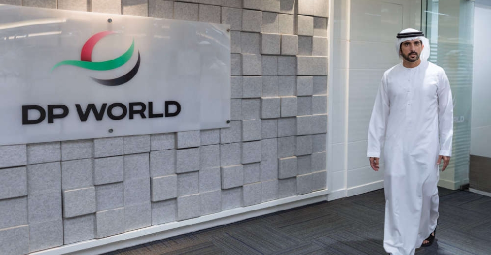 H.H. Sheikh Hamdan reviews operations, developments at Jebel Ali Port
 Drugs hidden inside passenger’s body seized at Abu Dhabi Airport
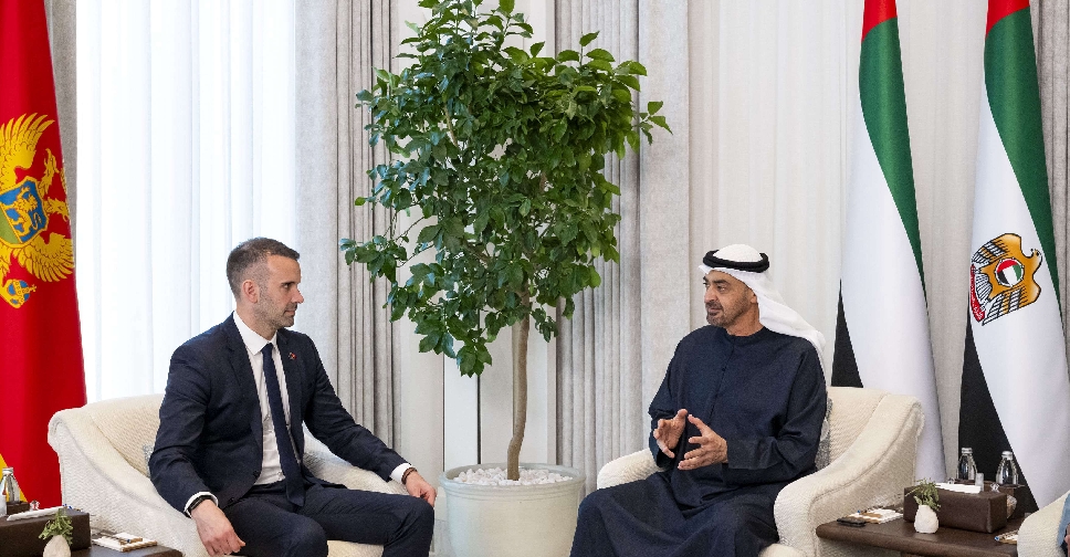 UAE President, Montenegro PM discuss stronger bilateral cooperation
 Fujairah says pipeline work triggered fire in petroleum industries area
 Yas Island announced as location for Sphere Abu Dhabi project
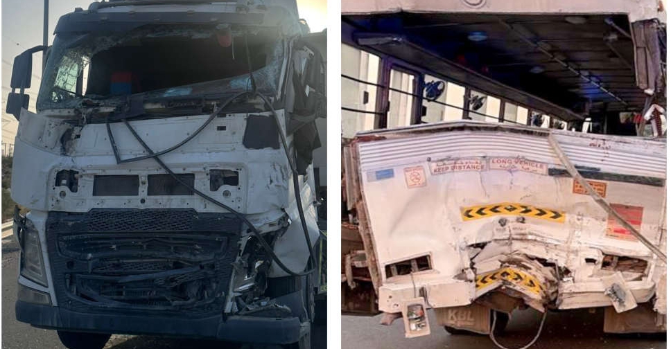 Warning issued on dangers of sudden road stops after 1 dead, 19 injured
 UAE says reports of Israeli PM Netanyahu's visit 'entirely unfounded'
 UAE launches platform to help Emiratis choose 'right academic, career paths'

